
TMW TRAIL MAPS
TRAIL MAPS
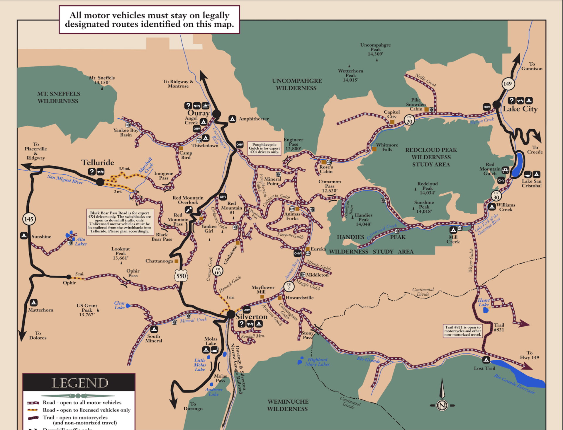
Thunder Mountain Wheelers Trail Maps
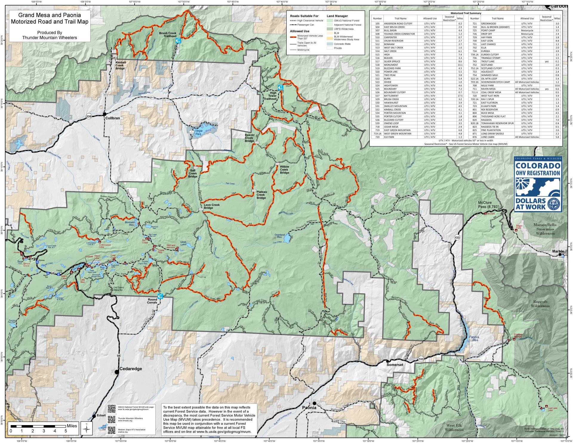
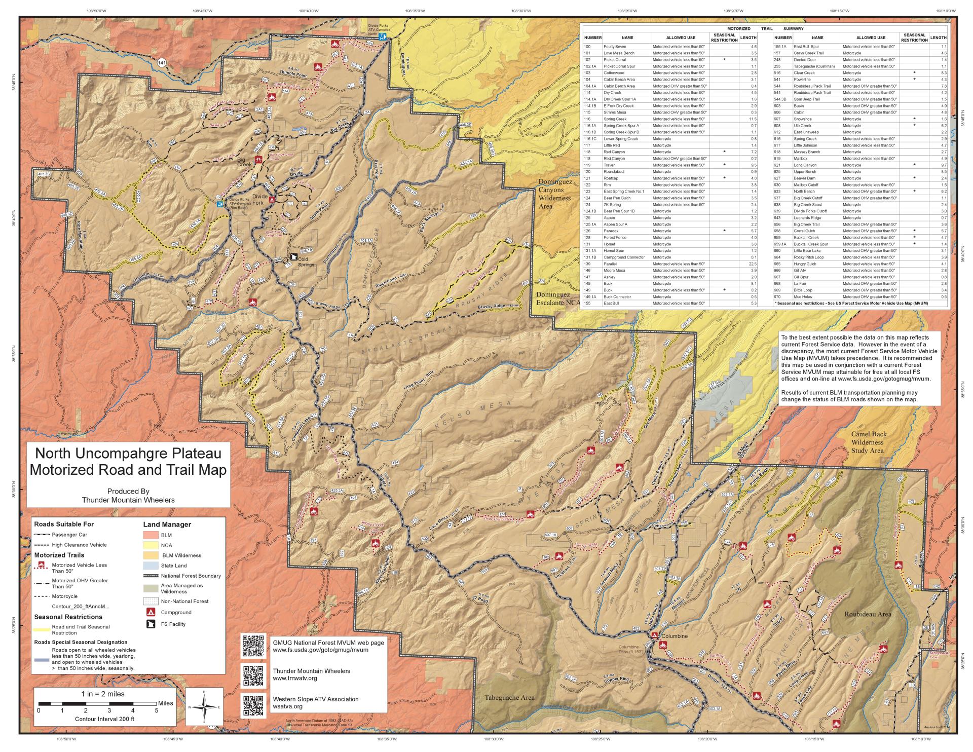
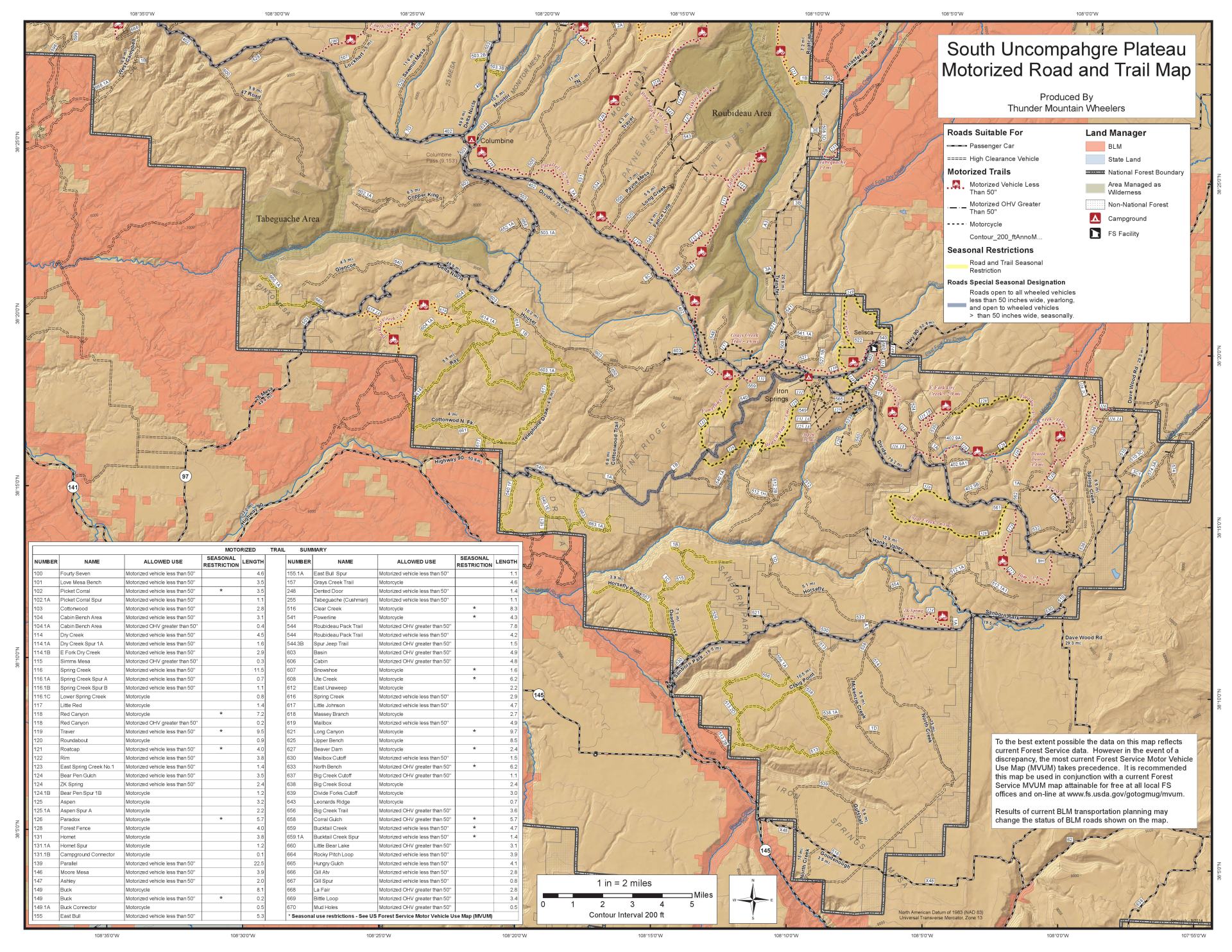
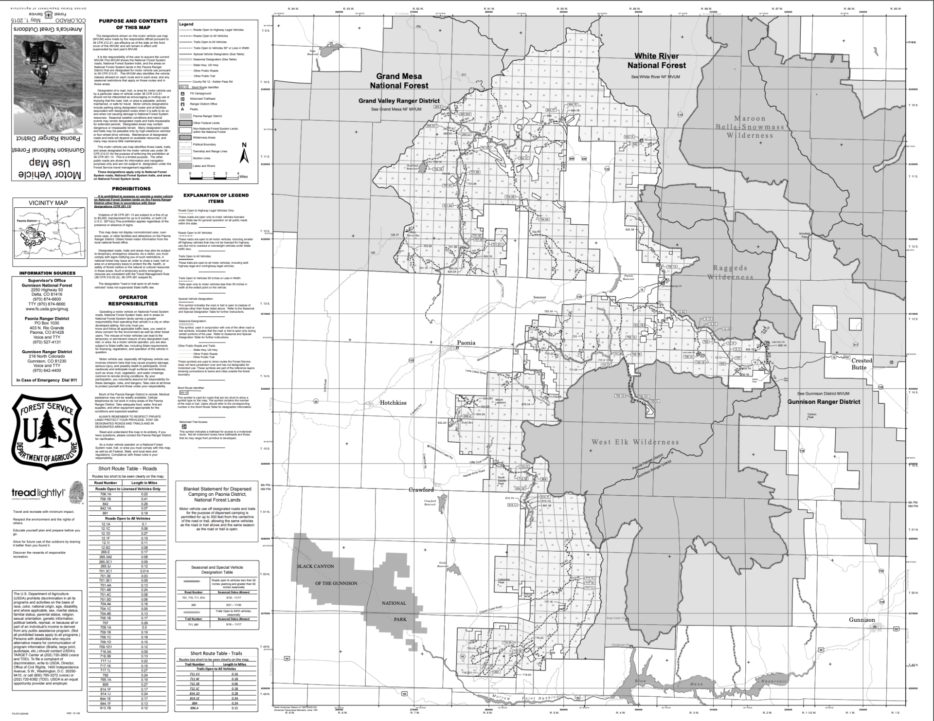
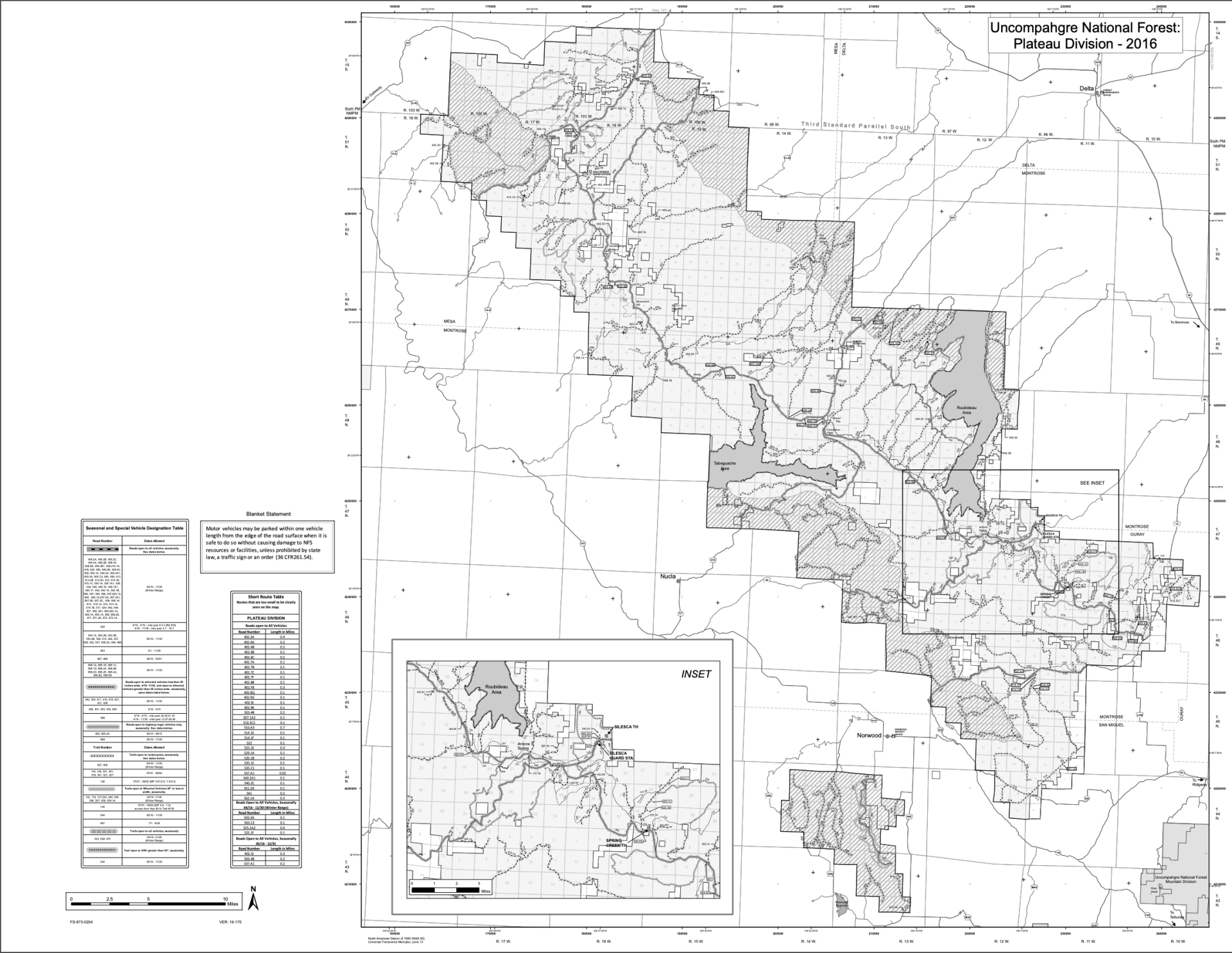
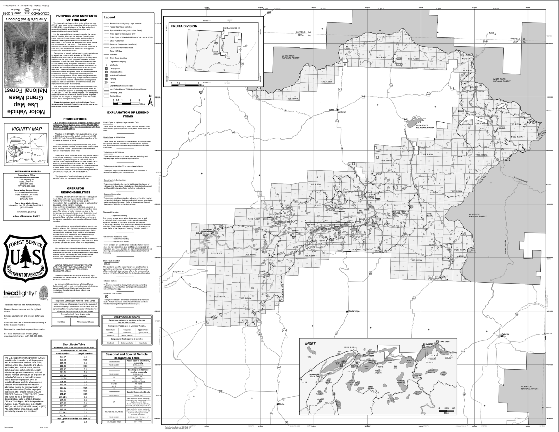
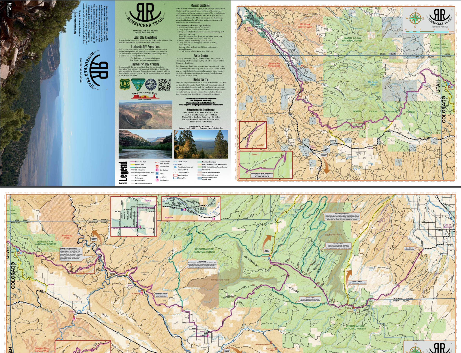
The Grand Mesa/Paonia and North/South Uncompahgre maps were created especially for TMW. These maps are waterproof and very durable. Funds for these maps were made possible by The Colorado Parks & Wildlife OHV Motorized Trail Grant Program. You should always refer to the most updated Forest Service Motorize Use Map before riding in a certain area. Click on the buttons below to print, view, or download.
Download one of the below applications to view our maps on the go!